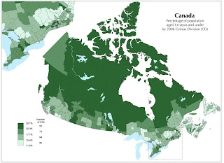
 This is a standardized choropleth map. The units and the variables remain standard throughout the entire map. This map is measuring the population of 14 years of age and under in Canada. The dark green areas represent 36% of the population is under 14. The light green, which seems to be mostly the large cities, are areas with less than 11%.
Monday, December 8, 2008
Standardized Choropleth Map
 This is a standardized choropleth map. The units and the variables remain standard throughout the entire map. This map is measuring the population of 14 years of age and under in Canada. The dark green areas represent 36% of the population is under 14. The light green, which seems to be mostly the large cities, are areas with less than 11%.
Subscribe to:
Post Comments (Atom)
No comments:
Post a Comment